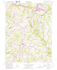
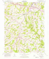
1944 Map of Damascus
USGS Topo · Published 1979About this map
Damascus sits at the heart of this mid-century landscape, a key crossroads connecting Montgomery, Frederick, and Howard counties. The northern reaches are defined by the Baltimore and Ohio rail line, which passes through Mount Airy and the industrial-sounding Plane No 4 near Bush Creek. This period shows a transition from a purely agricultural region toward early suburban development, while the winding Patuxent River and its tributaries like Bennett Creek and Great Seneca Creek preserve the area's natural contours.
Find a feature on this map
38 named features on this map. Tap any name to fly to it.
Don’t see what you’re looking for? This feature index may not catch every label — zoom into the map to look around manually.
Map Details
Editions of this 1944 Damascus Map
5 editions found
Other maps of this area

1893 · Frederick
USGS Topo · 1:125,000

1894 · Frederick
USGS Topo · 1:125,000

1908 · Rockville
USGS Topo · 1:62,500

1908 · Seneca
USGS Topo · 1:62,500

1908 · Ijamsville
USGS Topo · 1:62,500

1909 · Mount Airy
USGS Topo · 1:62,500

1909 · Ijamsville
USGS Topo · 1:62,500

1923 · Rockville
USGS Topo · 1:62,500

1942 · Frederick
USGS Topo · 1:62,500

1944 · Walkersville
USGS Topo · 1:31,680