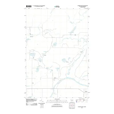
2010 Map of Danbury West
USGS Topo · Published 2010About this map
The Saint Croix River defines the southern boundary of this landscape, carving a prominent path near the settlement of Danbury. The terrain is characterized by a dense network of water bodies and marshy lowlands, including the Hay Creek Flowage and the meandering Lower Tamarack River. Cultural and historical sites are scattered throughout the township, most notably the Native American Burial Grounds near Saint Croix Camp and the Lena Lake Cemetery. The area serves as a significant recreational hub, evidenced by the numerous established sites like Jamar Scout Camp, Boulder Campground, and the Saint Croix Haven Campgrounds. Infrastructure such as the Hay Creek Dam and roads like Markville Rd and County Hwy F provide access to the various lakes, including Little Tamarack Lake and Lake Alma.
Find a feature on this map
43 named features on this map. Tap any name to fly to it.
Don’t see what you’re looking for? This feature index may not catch every label — zoom into the map to look around manually.
Map Details
Editions of this 2010 Danbury West Map
This is the sole edition of this map. No revisions or reprints were ever made.
Other maps of this area

1949 · Danbury
USGS Topo · 1:48,000

1950 · Webster
USGS Topo · 1:48,000

1950 · Grantsburg
USGS Topo · 1:48,000

1953 · Duluth
USGS Topo · 1:250,000

1953 · Stillwater
USGS Topo · 1:250,000

1955 · Webster
USGS Topo · 1:62,500

1955 · Stillwater
USGS Topo · 1:250,000

1958 · Stillwater
USGS Topo · 1:250,000

1958 · Duluth
USGS Topo · 1:250,000

1962 · Cloverdale
USGS Topo · 1:62,500