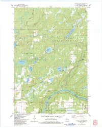
1983 Map of Danbury West
USGS Topo · Published 1983About this map
The St Croix National Scenic Riverway and the Lower Tamarack River define this wooded borderland between Wisconsin and Minnesota in the early 1980s. This survey illustrates a landscape primarily dedicated to public conservation and Indigenous heritage, notably featuring a portion of the Mille Lacs Indian Reservation and the Lena Lake Indian Center. The presence of several youth and recreational camps, including St Croix Camp and Jamar Scout Camp, alongside multiple campgrounds like Horseman's Campground, highlights the region's transition into a modern recreational hub.
Find a feature on this map
44 named features on this map. Tap any name to fly to it.
Don’t see what you’re looking for? This feature index may not catch every label — zoom into the map to look around manually.
Map Details
Editions of this 1983 Danbury West Map
This is the sole edition of this map. No revisions or reprints were ever made.
Other maps of this area

1949 · Danbury
USGS Topo · 1:48,000

1950 · Webster
USGS Topo · 1:48,000

1950 · Grantsburg
USGS Topo · 1:48,000

1953 · Duluth
USGS Topo · 1:250,000

1953 · Stillwater
USGS Topo · 1:250,000

1955 · Webster
USGS Topo · 1:62,500

1955 · Stillwater
USGS Topo · 1:250,000

1958 · Stillwater
USGS Topo · 1:250,000

1958 · Duluth
USGS Topo · 1:250,000

1962 · Cloverdale
USGS Topo · 1:62,500