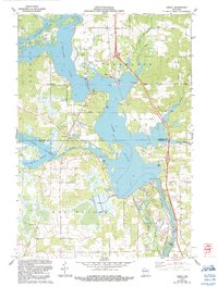
1970 Map of Dancy
USGS Topo · Published 1991About this map
Lake Du Bay dominates the central landscape of this 1970 survey, where the Wisconsin River meets the confluence of the Big Eau Pleine River and Little Eau Pleine River. The map captures a transition in Central Wisconsin as rural crossroads like Knowlton and Dancy developed alongside significant hydroelectric and industrial infrastructure, exemplified by the local Powerplant and the Little Eau Pleine Flowage.
Find a feature on this map
43 named features on this map. Tap any name to fly to it.
Don’t see what you’re looking for? This feature index may not catch every label — zoom into the map to look around manually.
Map Details
Editions of this 1970 Dancy Map
3 editions found
Other maps of this area

1899 · Wausau
USGS Topo · 1:125,000

1902 · Wausau
USGS Topo · 1:125,000

1902 · Marathon
USGS Topo · 1:125,000

1953 · Wausau
USGS Topo · 1:48,000

1953 · Marathon
USGS Topo · 1:48,000

1955 · Green Bay
USGS Topo · 1:250,000

1956 · Milladore
USGS Topo · 1:48,000

1956 · Stevens Point
USGS Topo · 1:48,000

1963 · Marathon
USGS Topo · 1:62,500

1963 · Wausau
USGS Topo · 1:62,500