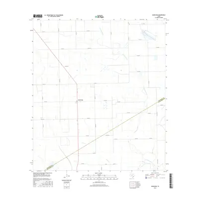
2016 Map of Danevang
USGS Topo · Published 2016About this map
Danevang serves as the central hub for this coastal prairie landscape, characterized by a highly organized grid of rural roads and drainage networks typical of the Texas Gulf Coast's agricultural heritage. The southern reaches of the map show the transition across the Wharton and Matagorda County line, where the terrain is subtly defined by the winding course of the Tres Palacios River and its tributaries, Willow Cr and Juanita Cr. The network of locally named thoroughfares such as Jurek Rd, John Fella Rd, and Baca Rd reflects the deep-rooted family ties and cultural history of the area. This 2016 survey documents the persistent rural character of the region, where land use remains closely tied to the natural watercourses that drain toward the Gulf, providing a detailed record of contemporary property boundaries and infrastructure.
Find a feature on this map
32 named features on this map. Tap any name to fly to it.
Don’t see what you’re looking for? This feature index may not catch every label — zoom into the map to look around manually.
Map Details
Editions of this 2016 Danevang Map
This is the sole edition of this map. No revisions or reprints were ever made.
Other maps of this area

1951 · Danevang
USGS Topo · 1:24,000

1952 · Lane City SE
USGS Topo · 1:24,000

1952 · Markham
USGS Topo · 1:24,000

1952 · Francitas NE
USGS Topo · 1:24,000

1952 · Lane City
USGS Topo · 1:24,000

1952 · Midfield
USGS Topo · 1:24,000

1952 · Pierce
USGS Topo · 1:24,000

1953 · Beeville
USGS Topo · 1:250,000

1953 · Seguin
USGS Topo · 1:250,000

1956 · Beeville
USGS Topo · 1:250,000