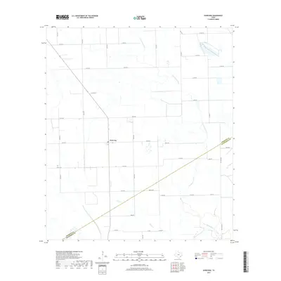
2019 Map of Danevang
USGS Topo · Published 2019About this map
The coastal prairie of the Texas Gulf Coast takes center stage here at the border of Wharton and Matagorda counties. The landscape is dominated by the agricultural settlement of Danevang, a community founded by Danish immigrants in the late 19th century, whose influence remains visible in the orderly grid of section roads like Baca Rd, Jurek Rd, and John Fella Rd. The terrain is characterized by a low-lying drainage network where the Tres Palacios River and its tributaries, Willow Cr and Juanita Cr, meander through open fields and pastures. This 2019 survey documents a rural infrastructure heavily reliant on state and county routes, including Farm Rd 403 and FM 1162 Rd, which facilitate the transport of goods across this productive agricultural corridor.
Find a feature on this map
32 named features on this map. Tap any name to fly to it.
Don’t see what you’re looking for? This feature index may not catch every label — zoom into the map to look around manually.
Map Details
Editions of this 2019 Danevang Map
This is the sole edition of this map. No revisions or reprints were ever made.
Other maps of this area

1951 · Danevang
USGS Topo · 1:24,000

1952 · Lane City SE
USGS Topo · 1:24,000

1952 · Markham
USGS Topo · 1:24,000

1952 · Francitas NE
USGS Topo · 1:24,000

1952 · Lane City
USGS Topo · 1:24,000

1952 · Midfield
USGS Topo · 1:24,000

1952 · Pierce
USGS Topo · 1:24,000

1953 · Beeville
USGS Topo · 1:250,000

1953 · Seguin
USGS Topo · 1:250,000

1956 · Beeville
USGS Topo · 1:250,000