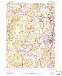
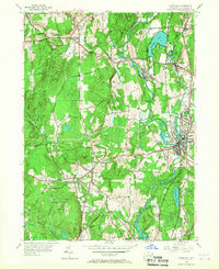
1955 Map of Danielson
USGS Topo · Published 1987About this map
The Quinebaug River valley serves as the industrial and residential spine of this Windham County landscape, anchoring a series of mill-related settlements such as Dayville, Attawaugan, and the primary borough of Danielson. By the mid-1950s, the region shows a dense network of civic and religious infrastructure, including Sacred Heart Convent and the Memorial Sch. Transportation through the river corridor is dominated by the Penn Central railroad, which parallels the water and connects several small villages like Rogers and Elmville.
Find a feature on this map
51 named features on this map. Tap any name to fly to it.
Don’t see what you’re looking for? This feature index may not catch every label — zoom into the map to look around manually.
Map Details
Editions of this 1955 Danielson Map
7 editions found
Other maps of this area

1889 · Putnam
USGS Topo · 1:62,500

1889 · Moosup
USGS Topo · 1:62,500

1892 · Woodstock
USGS Topo · 1:62,500

1892 · Norwich
USGS Topo · 1:62,500

1893 · Putnam
USGS Topo · 1:62,500

1893 · Moosup
USGS Topo · 1:62,500

1919 · Putnam
USGS Topo · 1:62,500

1920 · Moosup
USGS Topo · 1:62,500

1921 · Woodstock
USGS Topo · 1:62,500

1943 · Plainfield
USGS Topo · 1:31,680