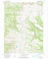
1966 Map of Danish Knoll
USGS Topo · Published 1978About this map
The Manti-La Sal National Forest in Sanpete County is defined here by its complex water management infrastructure and high-elevation research facilities. In the mid-1960s, the landscape featured a sophisticated network of canals and underground works, including the Ephraim Tunnel, Larsen Tunnel, and Horseshoe Tunnel, designed to move water across the rugged Wasatch Plateau. These engineering feats are complemented by agricultural research sites like the Great Basin Experiment Station and the Alpine Experiment Station, which underscore the region's importance for land management studies. Higher elevations along Skyline Drive reveal a series of distinctively named peaks and basins, such as Danish Knoll, Swedish Knoll, and the Soup Bowl. Recreational sites like Lake Hill Campground and high-country reservoirs including John August Lake provide a clear view of the area's mid-century utility as both a resource hub and a public refuge.
Find a feature on this map
61 named features on this map. Tap any name to fly to it.
Don’t see what you’re looking for? This feature index may not catch every label — zoom into the map to look around manually.
Map Details
Editions of this 1966 Danish Knoll Map
2 editions found
Other maps of this area

1885 · Manti
USGS Topo · 1:250,000

1895 · Manti
USGS Topo · 1:250,000

1922 · Wasatch
USGS Topo · 1:31,680

1956 · Price
USGS Topo · 1:250,000

1960 · Price
USGS Topo · 1:250,000

1962 · Price
USGS Topo · 1:250,000

1965 · Black Mountain
USGS Topo · 1:24,000
1966 · Ferron Reservoir
USGS Topo · 1:24,000

1966 · Spring City
USGS Topo · 1:24,000

1966 · Chester
USGS Topo · 1:24,000