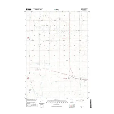
2016 Map of Danube
USGS Topo · Published 2016About this map
Renville County farmland surrounds the city of Danube and the western edge of Olivia in this mid-2010s topographic study. The landscape is heavily defined by its agricultural layout, with a dense network of township roads such as 850th Ave and 300th St carving the prairie into neat sections. This era shows the modern integration of rural infrastructure, including the Olivia Regional Airport situated between the two primary settlements.
Find a feature on this map
42 named features on this map. Tap any name to fly to it.
Don’t see what you’re looking for? This feature index may not catch every label — zoom into the map to look around manually.
Map Details
Editions of this 2016 Danube Map
This is the sole edition of this map. No revisions or reprints were ever made.
Other maps of this area

1952 · Morton
USGS Topo · 1:62,500

1952 · Redwood Falls
USGS Topo · 1:62,500

1953 · New Ulm
USGS Topo · 1:250,000

1957 · New Ulm
USGS Topo · 1:250,000

1957 · Olivia
USGS Topo · 1:62,500

1958 · New Ulm
USGS Topo · 1:250,000

1965 · Danube
USGS Topo · 1:24,000
1965 · Blomkest
USGS Topo · 1:24,000

1965 · Renville
USGS Topo · 1:24,000
1965 · Prinsburg
USGS Topo · 1:24,000