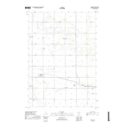
2019 Map of Danube
USGS Topo · Published 2019About this map
Danube and the western edge of Olivia anchor this agricultural landscape in Renville County, where a dense network of section-line roads like Co Rd 1 and 300th St divide the prairie into precise grids. The mapping reveals a high concentration of burial sites that mark the early spiritual centers of the region, including the Long Lake Mission Cem and the German Lutheran Cem. These small rural cemeteries, often set away from the primary settlements, reflect the immigrant heritage and early parish divisions of the late 19th and early 20th centuries.
Find a feature on this map
43 named features on this map. Tap any name to fly to it.
Don’t see what you’re looking for? This feature index may not catch every label — zoom into the map to look around manually.
Map Details
Editions of this 2019 Danube Map
This is the sole edition of this map. No revisions or reprints were ever made.
Other maps of this area

1952 · Morton
USGS Topo · 1:62,500

1952 · Redwood Falls
USGS Topo · 1:62,500

1953 · New Ulm
USGS Topo · 1:250,000

1957 · New Ulm
USGS Topo · 1:250,000

1957 · Olivia
USGS Topo · 1:62,500

1958 · New Ulm
USGS Topo · 1:250,000

1965 · Danube
USGS Topo · 1:24,000
1965 · Blomkest
USGS Topo · 1:24,000

1965 · Renville
USGS Topo · 1:24,000
1965 · Prinsburg
USGS Topo · 1:24,000