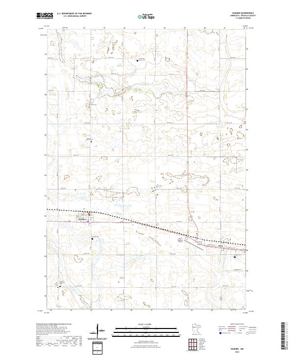
2022 Map of Danube
USGS Topo · Published 2022About this map
Danube and the western outskirts of Olivia anchor this agricultural landscape in Renville County, defined by a meticulously surveyed grid of township roads. The map reveals a high density of small burial grounds that speak to the area's early settlement patterns, including the Long Lake Mission Cem, German Lutheran Cem, and the Old Salem Cem. These sites, often situated near family farmsteads, provide vital links for local historians and genealogists.
Find a feature on this map
40 named features on this map. Tap any name to fly to it.
Don’t see what you’re looking for? This feature index may not catch every label — zoom into the map to look around manually.
Map Details
Editions of this 2022 Danube Map
This is the sole edition of this map. No revisions or reprints were ever made.
Other maps of this area

1952 · Morton
USGS Topo · 1:62,500

1952 · Redwood Falls
USGS Topo · 1:62,500

1953 · New Ulm
USGS Topo · 1:250,000

1957 · New Ulm
USGS Topo · 1:250,000

1957 · Olivia
USGS Topo · 1:62,500

1958 · New Ulm
USGS Topo · 1:250,000

1965 · Danube
USGS Topo · 1:24,000
1965 · Blomkest
USGS Topo · 1:24,000

1965 · Renville
USGS Topo · 1:24,000
1965 · Prinsburg
USGS Topo · 1:24,000