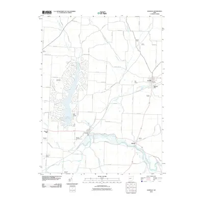
2010 Map of Danville
USGS Topo · Published 2010About this map
Danville and its neighbor Buckeye City anchor the northeastern portion of this Knox County landscape, where the traditional grid of the town center meets the winding valley of Jelloway Creek. This terrain is deeply marked by its watercourses, from the wide wetlands of the Kokosing River near Millwood to the man-made expanse of Apple Valley Lake. Local history and genealogy are preserved in a remarkably high density of family-named cemeteries and rural burial grounds, including the Branstool-Critchfield-Shrimplin Cemetery near Howard and the Saint Lukes Cemetery closer to town. The map documents a mix of 19th-century settlement patterns at Monroe Mills alongside the 20th-century recreational development of the Apple Valley Golf Course, illustrating the evolving use of the land from early milling and agriculture to modern residential communities.
Find a feature on this map
99 named features on this map. Tap any name to fly to it.
Don’t see what you’re looking for? This feature index may not catch every label — zoom into the map to look around manually.
Map Details
Editions of this 2010 Danville Map
This is the sole edition of this map. No revisions or reprints were ever made.
Other maps of this area

1912 · Loudonville
USGS Topo · 1:62,500

1912 · Gambier
USGS Topo · 1:62,500

1912 · Perrysville
USGS Topo · 1:62,500

1913 · Brinkhaven
USGS Topo · 1:62,500

1914 · Gambier
USGS Topo · 1:62,500

1914 · Loudonville
USGS Topo · 1:62,500

1915 · Brinkhaven
USGS Topo · 1:62,500

1915 · Perrysville
USGS Topo · 1:62,500

1943 · Gambier
USGS Topo · 1:62,500

1943 · Loudonville
USGS Topo · 1:62,500