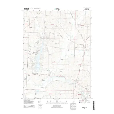
2013 Map of Danville
USGS Topo · Published 2013About this map
Danville and Howard serve as central nodes in this eastern Knox County landscape, where the Kokosing River and its various tributaries, including Jelloway Creek and Schenck Creek, shape the topography. The region is characterized by a mix of established residential clusters like Apple Valley and active agricultural operations such as Blanchard Swine Farms, Bratton Hog Farm, and Bullock Farms. The map reveals a dense network of country roads, from Danville Jelloway Road to Monroe Mills Road, connecting smaller locales like Millwood and Monroe Mills.
Find a feature on this map
149 named features on this map. Tap any name to fly to it.
Don’t see what you’re looking for? This feature index may not catch every label — zoom into the map to look around manually.
Map Details
Editions of this 2013 Danville Map
This is the sole edition of this map. No revisions or reprints were ever made.
Other maps of this area

1912 · Loudonville
USGS Topo · 1:62,500

1912 · Gambier
USGS Topo · 1:62,500

1912 · Perrysville
USGS Topo · 1:62,500

1913 · Brinkhaven
USGS Topo · 1:62,500

1914 · Gambier
USGS Topo · 1:62,500

1914 · Loudonville
USGS Topo · 1:62,500

1915 · Brinkhaven
USGS Topo · 1:62,500

1915 · Perrysville
USGS Topo · 1:62,500

1943 · Gambier
USGS Topo · 1:62,500

1943 · Loudonville
USGS Topo · 1:62,500