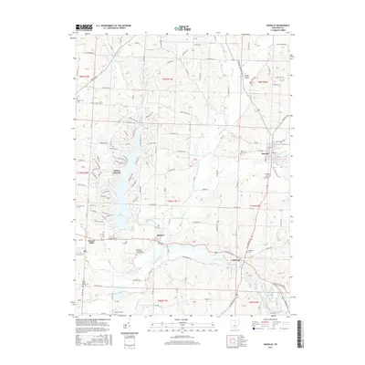
2016 Map of Danville
USGS Topo · Published 2016About this map
Danville and its surrounding hill country in Knox County are centered on the valley of Jelloway Cr and the waters of the Kokosing River. The landscape is a patchwork of small agricultural settlements and rural burial grounds, including the Banbury Cem and Saint Lukes Cem. To the west, the extensive waters of Apple Valley Lake dominate the geography, surrounded by a dense residential street network in Apple Valley. This modern development contrasts with the more traditional river settlements like Millwood and Monroe Mills, which sit along the lower reaches of the Kokosing. Genealogists will find interest in the numerous family and community cemeteries scattered across the townships, such as the Branstool-Critchfield-Shrimplin Cem and the Stone Quarry Chapel Cem, preserving the names of early local settlers.
Find a feature on this map
141 named features on this map. Tap any name to fly to it.
Don’t see what you’re looking for? This feature index may not catch every label — zoom into the map to look around manually.
Map Details
Editions of this 2016 Danville Map
This is the sole edition of this map. No revisions or reprints were ever made.
Other maps of this area

1912 · Loudonville
USGS Topo · 1:62,500

1912 · Gambier
USGS Topo · 1:62,500

1912 · Perrysville
USGS Topo · 1:62,500

1913 · Brinkhaven
USGS Topo · 1:62,500

1914 · Gambier
USGS Topo · 1:62,500

1914 · Loudonville
USGS Topo · 1:62,500

1915 · Brinkhaven
USGS Topo · 1:62,500

1915 · Perrysville
USGS Topo · 1:62,500

1943 · Gambier
USGS Topo · 1:62,500

1943 · Loudonville
USGS Topo · 1:62,500