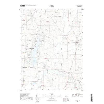
2019 Map of Danville
USGS Topo · Published 2019About this map
Jelloway Creek and its many tributaries, including Little Jelloway Creek and the East Branch Jelloway Creek, carve through the landscape of northeastern Knox County. This modern survey illustrates the residential growth around Apple Valley, where the sprawling Apple Valley Lake serves as a central landmark for the surrounding community. To the south, the Kokosing River flows past the historic settlements of Howard and Millwood, following a path that has shaped local transport for generations.
Find a feature on this map
143 named features on this map. Tap any name to fly to it.
Don’t see what you’re looking for? This feature index may not catch every label — zoom into the map to look around manually.
Map Details
Editions of this 2019 Danville Map
This is the sole edition of this map. No revisions or reprints were ever made.
Other maps of this area

1912 · Loudonville
USGS Topo · 1:62,500

1912 · Gambier
USGS Topo · 1:62,500

1912 · Perrysville
USGS Topo · 1:62,500

1913 · Brinkhaven
USGS Topo · 1:62,500

1914 · Gambier
USGS Topo · 1:62,500

1914 · Loudonville
USGS Topo · 1:62,500

1915 · Brinkhaven
USGS Topo · 1:62,500

1915 · Perrysville
USGS Topo · 1:62,500

1943 · Gambier
USGS Topo · 1:62,500

1943 · Loudonville
USGS Topo · 1:62,500