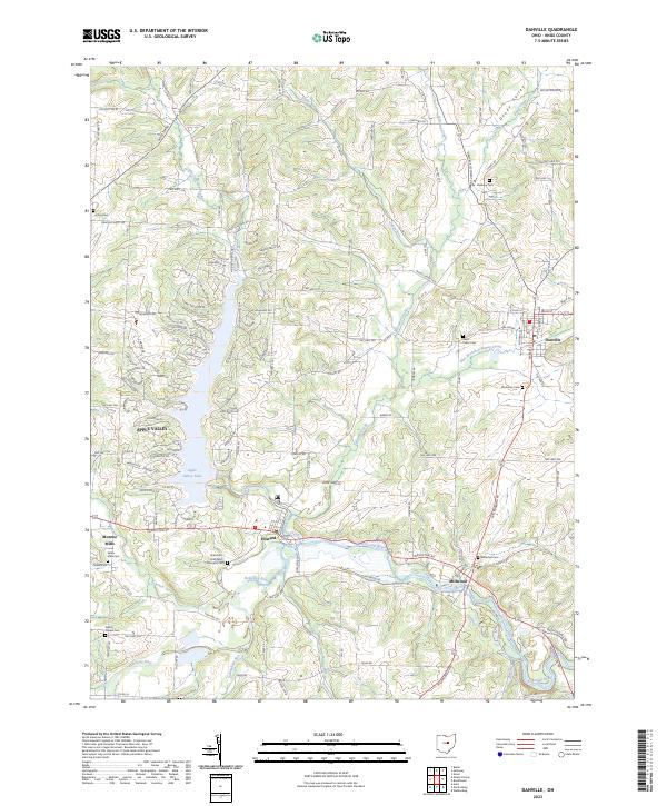
2023 Map of Danville
USGS Topo · Published 2023About this map
Danville and its surrounding Knox County townships sit at a point of transition where the rolling hills of north-central Ohio meet a complex drainage network. The landscape is defined by the Kokosing River, which winds along the southern edge of the map, joined by tributaries such as Schenck Creek and Jelloway Creek. This water-rich geography is centered on the prominent Apple Valley Lake, a significant reservoir surrounded by a dense residential grid that contrasts with the scattered farmsteads of the rural interior.
Find a feature on this map
149 named features on this map. Tap any name to fly to it.
Don’t see what you’re looking for? This feature index may not catch every label — zoom into the map to look around manually.
Map Details
Editions of this 2023 Danville Map
This is the sole edition of this map. No revisions or reprints were ever made.
Other maps of this area

1912 · Loudonville
USGS Topo · 1:62,500

1912 · Gambier
USGS Topo · 1:62,500

1912 · Perrysville
USGS Topo · 1:62,500

1913 · Brinkhaven
USGS Topo · 1:62,500

1914 · Gambier
USGS Topo · 1:62,500

1914 · Loudonville
USGS Topo · 1:62,500

1915 · Brinkhaven
USGS Topo · 1:62,500

1915 · Perrysville
USGS Topo · 1:62,500

1943 · Gambier
USGS Topo · 1:62,500

1943 · Loudonville
USGS Topo · 1:62,500