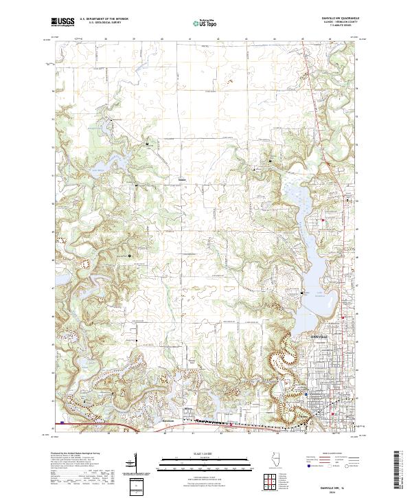
2024 Map of Danville NW
USGS Topo · Published 2024About this map
Lake Vermilion and the North Fork Vermilion River dominate the eastern landscape of this Vermilion County region, where the urban edge of Danville meets rural townships. The map documents a significant network of local cemeteries, including Fairchild Cem, Bethel Cem, and Snider Cem, which serve as critical markers for genealogical research in these longstanding communities. The southern portion of the quadrangle shows the residential and industrial character of Hillery and Hartshorn, situated near the complex hydrology of Emerald Pond and Inland Sea.
Find a feature on this map
100 named features on this map. Tap any name to fly to it.
Don’t see what you’re looking for? This feature index may not catch every label — zoom into the map to look around manually.
Map Details
Editions of this 2024 Danville NW Map
This is the sole edition of this map. No revisions or reprints were ever made.
Other maps of this area

1899 · Danville
USGS Topo · 1:62,500

1900 · Danville
USGS Topo · 1:62,500

1931 · Fithian
USGS Topo · 1:48,000

1933 · Hoopeston
USGS Topo · 1:48,000

1936 · Potomac
USGS Topo · 1:62,500

1938 · Hoopeston
USGS Topo · 1:62,500

1943 · Fithian
USGS Topo · 1:62,500

1948 · Danville NW
USGS Topo · 1:24,000

1949 · Danville SW
USGS Topo · 1:24,000

1950 · Danville SW
USGS Topo · 1:24,000