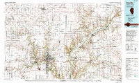
1987 Map of Danville
USGS Topo · Published 1994About this map
The Vermilion River and its multiple forks define the landscape around Danville in the 1980s, where industrial roots meet preserved natural areas. This map documents a region heavily influenced by its geological resources, showing numerous Strip Mine sites and a Gravel Pit interspersed between agricultural centers. The city of Danville serves as the regional hub, housing the Vermilion County Courthouse, Danville Junior College, and the Veterans Administration Hospital.
Find a feature on this map
166 named features on this map. Tap any name to fly to it.
Don’t see what you’re looking for? This feature index may not catch every label — zoom into the map to look around manually.
Map Details
Editions of this 1987 Danville Map
This is the sole edition of this map. No revisions or reprints were ever made.
Other maps of this area

1899 · Danville
USGS Topo · 1:62,500

1900 · Danville
USGS Topo · 1:62,500

1906 · Urbana
USGS Topo · 1:62,500

1924 · Paxton
USGS Topo · 1:62,500

1927 · Paxton
USGS Topo · 1:62,500

1931 · Fithian
USGS Topo · 1:48,000

1933 · Hoopeston
USGS Topo · 1:48,000

1936 · Potomac
USGS Topo · 1:62,500

1938 · Milford
USGS Topo · 1:48,000

1938 · Hoopeston
USGS Topo · 1:62,500