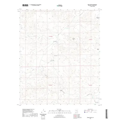
2020 Map of Dark Canyon
USGS Topo · Published 2020About this map
The high desert landscape of Chaves County is defined by a complex network of arroyos and drainage basins, notably the central Dark Canyon. This 2020 topographic study illustrates the sparse but intentional infrastructure required to navigate the basin and range province of New Mexico, where narrow county roads like Co RD 145 and Squaw Canyon Rd follow the natural contours of the land. Water sources, while infrequent, are localized around features such as Dagger Lake and Squaw Cr, which serve as vital points of interest in an otherwise arid environment. The map details a series of named geographical features, from Horse Canyon to Montoya Canyon, that have likely served as landmarks for generations of local ranchers and travelers. The land is organized by the Public Land Survey System, shown here across the boundaries of Townships 14 and 15 South.
Find a feature on this map
19 named features on this map. Tap any name to fly to it.
Don’t see what you’re looking for? This feature index may not catch every label — zoom into the map to look around manually.
Map Details
Editions of this 2020 Dark Canyon Map
This is the sole edition of this map. No revisions or reprints were ever made.
Other maps of this area

1954 · Carlsbad
USGS Topo · 1:250,000

1955 · Roswell
USGS Topo · 1:250,000

1958 · Carlsbad
USGS Topo · 1:250,000

1958 · Roswell
USGS Topo · 1:250,000

1960 · Teel Ranch
USGS Topo · 1:62,500

1961 · Flying H
USGS Topo · 1:62,500

1961 · Indian Bluff
USGS Topo · 1:62,500

1962 · Roswell
USGS Topo · 1:250,000

1962 · Dunken
USGS Topo · 1:62,500

1978 · Artesia
USGS Topo · 1:100,000