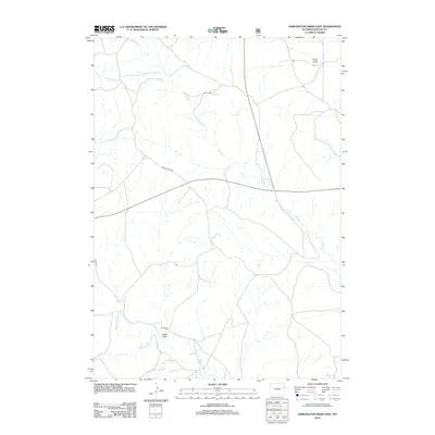
2012 Map of Darlington Draw East
USGS Topo · Published 2012About this map
Wildcat Cr defines the drainage pattern of this landscape in Weston County, winding southward through a region characterized by ranching and open range. The map documents long-established land holdings such as Hamm Ranch in the north and Field Ranch near the southern boundary, illustrating the persistent agricultural footprint in eastern Wyoming.
Find a feature on this map
10 named features on this map. Tap any name to fly to it.
Don’t see what you’re looking for? This feature index may not catch every label — zoom into the map to look around manually.
Map Details
Editions of this 2012 Darlington Draw East Map
This is the sole edition of this map. No revisions or reprints were ever made.
Other maps of this area

1955 · Newcastle
USGS Topo · 1:250,000

1958 · Newcastle
USGS Topo · 1:250,000

1979 · Newcastle
USGS Topo · 1:100,000
1982 · Darlington Draw West
USGS Topo · 1:24,000
1982 · Wildlife Draw West
USGS Topo · 1:24,000
1982 · Lion Creek
USGS Topo · 1:24,000
1982 · Poddy Creek
USGS Topo · 1:24,000

1982 · Clareton
USGS Topo · 1:24,000
1982 · Wildlife Draw East
USGS Topo · 1:24,000
1982 · The Nose West
USGS Topo · 1:24,000