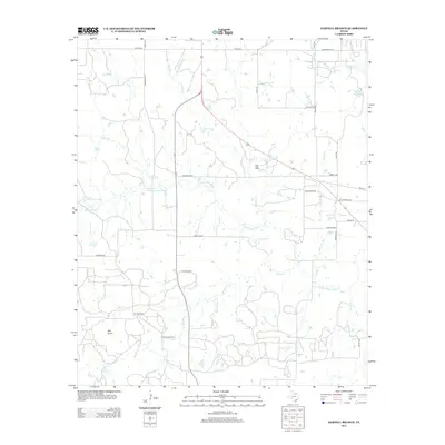
2012 Map of Darnell Branch
USGS Topo · Published 2012About this map
The W Fork Trinity River winds through this North Texas landscape, defining a terrain shaped by both agricultural ranching and industrial extraction. The presence of the Prideaux Oil Field in the southern portion of the quadrangle highlights the region's long-standing connection to the petroleum industry. Elevated landmarks like Gap Mtn and Spy Knob rise above the network of seasonal creeks and branches, including Darnell Br, Brushy Cr, and Dead Horse Cr. A grid of rural roads—such as Prideaux Rd, Mail Route Rd, and MX Ranch Rd—connects scattered homesteads and ranches, reflecting a settlement pattern centered on large landholdings and energy production during the early 21st century.
Find a feature on this map
34 named features on this map. Tap any name to fly to it.
Don’t see what you’re looking for? This feature index may not catch every label — zoom into the map to look around manually.
Map Details
Editions of this 2012 Darnell Branch Map
This is the sole edition of this map. No revisions or reprints were ever made.
Other maps of this area

1931 · Archer City
USGS Topo · 1:62,500

1954 · Wichita Falls
USGS Topo · 1:250,000

1958 · Wichita Falls
USGS Topo · 1:250,000

1962 · Windthorst
USGS Topo · 1:24,000

1962 · Antelope Creek NE
USGS Topo · 1:24,000

1963 · Archer City East
USGS Topo · 1:24,000

1964 · Darnell Branch
USGS Topo · 1:24,000

1964 · Loving
USGS Topo · 1:24,000

1964 · Lynn Creek
USGS Topo · 1:24,000

1964 · Antelope
USGS Topo · 1:24,000