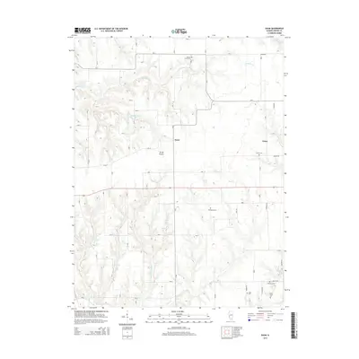
2015 Map of Daum
USGS Topo · Published 2015About this map
String Prairie and the small settlements of Daum and Kahm anchor this rural Greene County landscape, illustrating a classic Midwestern pattern of dispersed agricultural communities. The terrain is deeply etched by a network of waterways, including Whitaker Cr, Bear Cr, and the notably named Little Bear Rough, which drain toward Taylor Cr in the south. These drainage patterns influenced early road placement and property boundaries throughout the 20th century.
Find a feature on this map
27 named features on this map. Tap any name to fly to it.
Don’t see what you’re looking for? This feature index may not catch every label — zoom into the map to look around manually.
Map Details
Editions of this 2015 Daum Map
This is the sole edition of this map. No revisions or reprints were ever made.
Other maps of this area

1924 · Roodhouse
USGS Topo · 1:62,500

1925 · Brighton
USGS Topo · 1:62,500

1926 · Roodhouse
USGS Topo · 1:62,500

1928 · Brighton
USGS Topo · 1:62,500

1930 · Jerseyville
USGS Topo · 1:62,500

1932 · Greenfield
USGS Topo · 1:62,500

1933 · Jerseyville
USGS Topo · 1:62,500

1948 · Quincy
USGS Topo · 1:250,000

1956 · Quincy
USGS Topo · 1:250,000
1983 · Boyer Creek
USGS Topo · 1:24,000