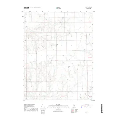
2018 Map of Daum
USGS Topo · Published 2018About this map
Daum and the nearby locale of String Prairie anchor this rural landscape in Greene County, where the terrain is defined by a dense network of creek drainages. The local geography is heavily influenced by the winding paths of Bear Cr and its tributaries, including Little Bear Rough, which carve deep contours into the Illinois prairie. This area is notably dense with small family or community burial grounds, such as Hickory Grove Cem and Hardcastle Cem, providing a clear spatial record for genealogical research. The settlement pattern follows established section lines and local connectors like Daum Rd and Wayham Rd, connecting the scattered homesteads of Kahm to the larger surrounding agricultural tracts. This 2018 survey documents a region where traditional land divisions and small-scale cemeteries remain the primary landmarks across the drainage basins of Whitaker Cr and Sand Br.
Find a feature on this map
33 named features on this map. Tap any name to fly to it.
Don’t see what you’re looking for? This feature index may not catch every label — zoom into the map to look around manually.
Map Details
Editions of this 2018 Daum Map
This is the sole edition of this map. No revisions or reprints were ever made.
Other maps of this area

1924 · Roodhouse
USGS Topo · 1:62,500

1925 · Brighton
USGS Topo · 1:62,500

1926 · Roodhouse
USGS Topo · 1:62,500

1928 · Brighton
USGS Topo · 1:62,500

1930 · Jerseyville
USGS Topo · 1:62,500

1932 · Greenfield
USGS Topo · 1:62,500

1933 · Jerseyville
USGS Topo · 1:62,500

1948 · Quincy
USGS Topo · 1:250,000

1956 · Quincy
USGS Topo · 1:250,000
1983 · Boyer Creek
USGS Topo · 1:24,000