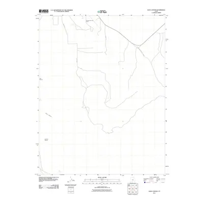
2011 Map of Dave Canyon
USGS Topo · Published 2011About this map
Escalante Municipal Airport serves as a modern waypoint in this high-desert landscape, situated just north of the canyon systems that define the Garfield County terrain. The landscape is carved by seasonal watercourses and drainage networks, most notably Dave Canyon and Bull Run Canyon, which dominate the southern half of the quadrangle. These geological features emphasize the isolation of the area, where water sources like Rock Spring and Oak Spring were critical for early transit and land use. Access through this region is maintained by a network of local routes including Proctor Rd and Sawmill Rd, while the Glen Canyon National Rec Area Rd cuts across the northeastern section. This 2011 survey illustrates the intersection of modern infrastructure and the enduring natural topography of southern Utah.
Find a feature on this map
10 named features on this map. Tap any name to fly to it.
Don’t see what you’re looking for? This feature index may not catch every label — zoom into the map to look around manually.
Map Details
Editions of this 2011 Dave Canyon Map
This is the sole edition of this map. No revisions or reprints were ever made.
Other maps of this area

1886 · Escalante
USGS Topo · 1:250,000

1956 · Escalante
USGS Topo · 1:250,000

1960 · Escalante
USGS Topo · 1:250,000

1964 · Tenmile Flat
USGS Topo · 1:24,000

1964 · Dave Canyon
USGS Topo · 1:24,000
1964 · Calf Creek
USGS Topo · 1:24,000

1964 · Canaan Creek
USGS Topo · 1:24,000

1964 · Seep Flat
USGS Topo · 1:24,000

1964 · Death Ridge
USGS Topo · 1:24,000

1964 · Carcass Canyon
USGS Topo · 1:24,000