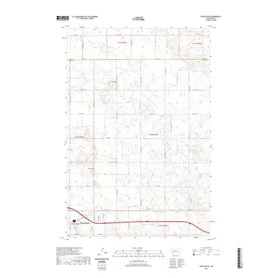
2020 Map of Davis Buttes
USGS Topo · Published 2020About this map
Dickinson anchors the southwest corner of this Stark County landscape, revealing the town's industrial and infrastructure expansion at the start of the 2020s. The map illustrates a transition from the urban grid of E Villard St to specialized corridors like Energy Dr, Implement Dr, and Lehigh Rd, reflecting the area's modern economic base. Beyond the city limits, the terrain rises toward the namesake Davis Buttes and Simon Butte, which stand as prominent landmarks above the drainage of the Green River and Russian Spring Cr. This survey provides a clear look at the section-line road network, such as 30th St SW and 107th Ave SW, which organizes the high plains into a distinct geometric pattern, typical of the western North Dakota prairie as it meets the edge of development.
Find a feature on this map
35 named features on this map. Tap any name to fly to it.
Don’t see what you’re looking for? This feature index may not catch every label — zoom into the map to look around manually.
Map Details
Editions of this 2020 Davis Buttes Map
This is the sole edition of this map. No revisions or reprints were ever made.
Other maps of this area

1953 · Dickinson
USGS Topo · 1:250,000

1953 · Watford City
USGS Topo · 1:250,000

1957 · Dickinson
USGS Topo · 1:250,000

1957 · Watford City
USGS Topo · 1:250,000

1959 · Dickinson North
USGS Topo · 1:24,000

1959 · Dickinson South
USGS Topo · 1:24,000

1959 · Lehigh
USGS Topo · 1:24,000

1962 · Davis Buttes
USGS Topo · 1:24,000

1967 · Watford City
USGS Topo · 1:250,000

1973 · Boyle
USGS Topo · 1:24,000