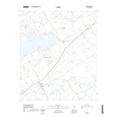
2019 Map of Dawson
USGS Topo · Published 2019About this map
Dawson serves as the primary hub in this Navarro County landscape, where the town’s grid is clearly defined amidst a network of farm-to-market roads and rural routes. The hydrology of the region is dominated by Navarro Mills Lake in the northwest, which feeds into a complex system of drainage including Richland Cr and Battle Cr. A significant feature of this era is the extensive presence of Soil Conservation Service reservoirs, such as Site 111 and Site 114, which represent decades of water management and erosion control efforts in the Texas Blackland Prairies.
Find a feature on this map
109 named features on this map. Tap any name to fly to it.
Don’t see what you’re looking for? This feature index may not catch every label — zoom into the map to look around manually.
Map Details
Editions of this 2019 Dawson Map
This is the sole edition of this map. No revisions or reprints were ever made.
Other maps of this area

1954 · Dallas
USGS Topo · 1:250,000

1954 · Waco
USGS Topo · 1:250,000

1955 · Waco
USGS Topo · 1:250,000

1956 · Hubbard
USGS Topo · 1:24,000

1956 · Dawson
USGS Topo · 1:24,000

1957 · Irene
USGS Topo · 1:24,000

1958 · Dallas
USGS Topo · 1:250,000

1965 · Coolidge
USGS Topo · 1:24,000
1965 · Blooming Grove
USGS Topo · 1:24,000
1965 · Corbet
USGS Topo · 1:24,000