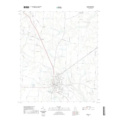
2020 Map of Dawson
USGS Topo · Published 2020About this map
The Terrell County Courthouse stands as the central landmark of Dawson, Georgia, anchoring a landscape where small agricultural settlements like Oakville, Yeomans, and Pleasant Hill dot the terrain. The town's layout is defined by a grid of numbered avenues and named streets, while the surrounding countryside is characterized by an extensive network of county roads such as Wilbur Gamble Rd and Homer Fillingame Rd. Numerous family and community cemeteries, including Cedar Hill Cem, Sardis Cem, and Zion Cem, provide significant touchpoints for local genealogists.
Find a feature on this map
113 named features on this map. Tap any name to fly to it.
Don’t see what you’re looking for? This feature index may not catch every label — zoom into the map to look around manually.
Map Details
Editions of this 2020 Dawson Map
This is the sole edition of this map. No revisions or reprints were ever made.
Other maps of this area

1953 · Dothan
USGS Topo · 1:250,000

1954 · Dothan
USGS Topo · 1:250,000

1955 · Dothan
USGS Topo · 1:250,000

1956 · Sasser
USGS Topo · 1:62,500

1972 · Parrott
USGS Topo · 1:24,000

1972 · Shellman
USGS Topo · 1:24,000

1973 · Chickasawhatchee
USGS Topo · 1:24,000

1973 · Sasser
USGS Topo · 1:24,000

1973 · Dawson
USGS Topo · 1:24,000
1973 · Bottsford
USGS Topo · 1:24,000