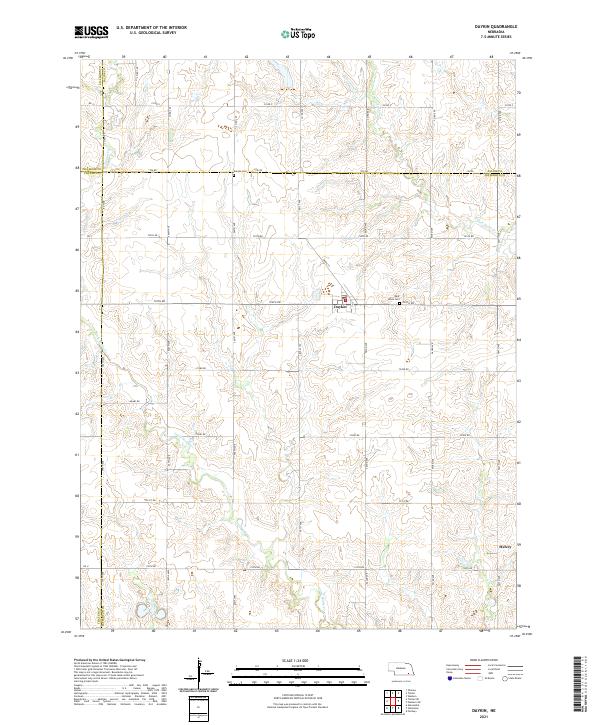
2021 Map of Daykin
USGS Topo · Published 2021About this map
The village of Daykin serves as the primary hub in this portion of Jefferson County, where the agricultural grid is etched across the drainages of Little Sandy Cr and the S Fork Swan Cr. The landscape is defined by the intersection of four counties—Jefferson, Saline, Thayer, and Fillmore—reflecting the systematic land division of the Great Plains. Local history is anchored by sites such as Saint Johns Cem near the town center and Eureka Cem along the northern border, providing vital points of reference for genealogical research in this rural corridor.
Find a feature on this map
33 named features on this map. Tap any name to fly to it.
Don’t see what you’re looking for? This feature index may not catch every label — zoom into the map to look around manually.
Map Details
Editions of this 2021 Daykin Map
This is the sole edition of this map. No revisions or reprints were ever made.
Other maps of this area

1955 · Lincoln
USGS Topo · 1:250,000

1957 · Lincoln
USGS Topo · 1:250,000

1958 · Lincoln
USGS Topo · 1:250,000

1960 · Western SW
USGS Topo · 1:24,000

1960 · Fairbury
USGS Topo · 1:24,000

1960 · Tobias SW
USGS Topo · 1:24,000

1960 · Alexandria
USGS Topo · 1:24,000
1960 · Gladstone
USGS Topo · 1:24,000

1960 · Daykin
USGS Topo · 1:24,000

1961 · Tobias
USGS Topo · 1:24,000