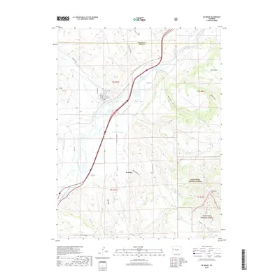
2019 Map of De Beque
USGS Topo · Published 2019About this map
De Beque sits at the northern end of its namesake De Beque Canyon, serving as a focal point where the Colorado River meets a complex network of agricultural irrigation and high desert terrain. This 2019 survey illustrates the vital water management infrastructure supporting the region, from the Bluestone Valley Ditch and Larkin Ditch to the Roan Cr Ditch Number 2. The landscape transitions from the river valley floor to the protected elevations of the White River National Forest and Grand Mesa National Forest. Geologic and topographic features such as Horsethief Mtn, Samson Mesa, and Ashmead Draw frame the settlement, while the presence of the De Beque Reservoir and Sunnyside Reservoir highlight the continued importance of water storage in this Mesa County corridor.
Find a feature on this map
56 named features on this map. Tap any name to fly to it.
Don’t see what you’re looking for? This feature index may not catch every label — zoom into the map to look around manually.
Map Details
Editions of this 2019 De Beque Map
This is the sole edition of this map. No revisions or reprints were ever made.
Other maps of this area

1929 · Grand Valley
USGS Topo · 1:62,500

1929 · Roan Creek
USGS Topo · 1:62,500

1955 · Cameo
USGS Topo · 1:24,000

1955 · Mesa
USGS Topo · 1:24,000

1955 · Molina
USGS Topo · 1:24,000

1956 · Grand Junction
USGS Topo · 1:250,000

1959 · Grand Junction
USGS Topo · 1:250,000

1960 · Grand Junction
USGS Topo · 1:250,000

1962 · Grand Junction
USGS Topo · 1:250,000
1962 · Grand Valley
USGS Topo · 1:24,000