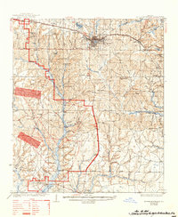
1938 Map of De Funiak Springs
USGS Topo · Published 1944About this map
The Louisville and Nashville Railroad serves as a primary east-west spine for Walton County in the late 1930s, connecting the county seat at De Funiak Springs with smaller outposts like Argyle. The landscape is defined by its timber and water resources, evidenced by the Cawthon Mill and numerous mill ponds such as Cosson Mill Pond and Sconters Mill Pond. Outside the main town, a network of one-room schoolhouses like Ionic Sch and Bell Sch anchor the rural community alongside local houses of worship including Gillis Chapel and Macedonia Ch. To the south, the terrain slopes toward the coastal lowlands of Freeport and Portland, where Alaqua Creek and Bruce Creek drain into the Choctawhatchee Bay watershed. Significant historical infrastructure is noted by the Spanish Trail and the Old Walton Bridge, marking routes that preceded the modern highway system.
Find a feature on this map
86 named features on this map. Tap any name to fly to it.
Don’t see what you’re looking for? This feature index may not catch every label — zoom into the map to look around manually.
Map Details
Editions of this 1938 De Funiak Springs Map
4 editions found
Other maps of this area

1934 · Niceville
USGS Topo · 1:48,000

1935 · Villa Tasso
USGS Topo · 1:48,000

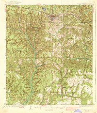
1935 · De Funiak Springs
USGS Topo · 1:48,000

1936 · Niceville
USGS Topo · 1:62,500

1936 · Point Washington
USGS Topo · 1:48,000

1938 · Villa Tasso
USGS Topo · 1:62,500

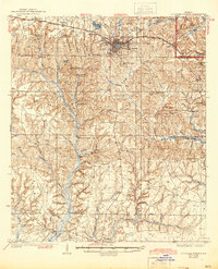
1938 · De Funiak Springs
USGS Topo · 1:62,500

1939 · Point Washington
USGS Topo · 1:62,500

1944 · Bruce
USGS Topo · 1:24,000

1945 · Bruce
USGS Topo · 1:31,680