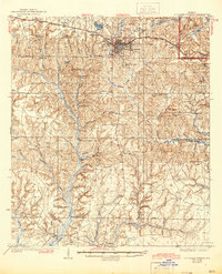
1938 Map of De Funiak Springs
USGS Topo · Published 1944About this map
De Funiak Springs serves as the focal point of this 1930s Florida landscape, where the circular town plan sits at the junction of the Louisville and Nashville railroad and the Old Spanish Trail. The surrounding territory in Walton County is defined by a dense network of creek systems, including the Shoal River and Alaqua Creek, which supported early rural industries like Cossom Mill and Scooters Mill Pond.
Find a feature on this map
71 named features on this map. Tap any name to fly to it.
Don’t see what you’re looking for? This feature index may not catch every label — zoom into the map to look around manually.
Map Details
Editions of this 1938 De Funiak Springs Map
4 editions found
Other maps of this area

1934 · Niceville
USGS Topo · 1:48,000

1935 · Villa Tasso
USGS Topo · 1:48,000

1935 · De Funiak Springs
USGS Topo · 1:48,000

1936 · Niceville
USGS Topo · 1:62,500

1936 · Point Washington
USGS Topo · 1:48,000

1938 · Villa Tasso
USGS Topo · 1:62,500

1938 · De Funiak Springs
USGS Topo · 1:62,500

1939 · Point Washington
USGS Topo · 1:62,500

1944 · Bruce
USGS Topo · 1:24,000

1945 · Bruce
USGS Topo · 1:31,680