
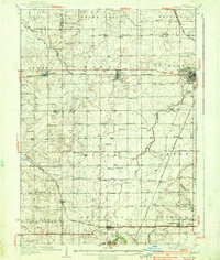
1937 Map of De Kalb
USGS Topo · Published 1937About this map
Lincoln Highway cuts across the northern half of this landscape, connecting the growing hub of De Kalb with smaller prairie rail towns like Malta and Creston. This survey reflects an agricultural economy in transition, where a dense network of country schools, such as Toad Hollow Sch and Milan Sch, still anchors rural life between the expanding rail corridors of the Chicago and Northwestern and the Chicago Burlington and Quincy.
Find a feature on this map
86 named features on this map. Tap any name to fly to it.
Don’t see what you’re looking for? This feature index may not catch every label — zoom into the map to look around manually.
Map Details
Editions of this 1937 De Kalb Map
2 editions found
Other maps of this area

1917 · Kings
USGS Topo · 1:62,500

1918 · Kings
USGS Topo · 1:62,500

1918 · Kirkland
USGS Topo · 1:62,500

1934 · De Kalb
USGS Topo · 1:62,500

1937 · Sycamore
USGS Topo · 1:62,500

1938 · Genoa
USGS Topo · 1:62,500

1948 · Sandwich
USGS Topo · 1:62,500

1950 · Sandwich
USGS Topo · 1:62,500

1951 · Earlville
USGS Topo · 1:62,500

1952 · Rochelle
USGS Topo · 1:62,500