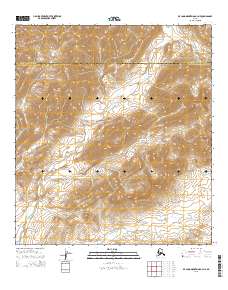
2015 Map of De Long Mountains A-3 NE
USGS Topo · Published 2015About this map
De Long Mountains terrain dominates this 2015 survey of a high-latitude wilderness where the headwaters of the W Fork Wulik River carve through a landscape defined by sharp elevation shifts and expansive drainage basins. The map illustrates a political boundary of significant geographic scale, tracing the line where the North Slope Borough meets the Northwest Arctic Borough. This area is characterized by its isolation and lack of human infrastructure, focusing entirely on the natural hydrography and topographical contouring that shape the northwestern Alaskan interior. Surveyors from the U.S. Geological Survey documented the intricate flow of the river's western fork as it meanders through the foothills, providing a clear view of the drainage patterns essential for understanding this subarctic environment.
Find a feature on this map
7 named features on this map. Tap any name to fly to it.
Don’t see what you’re looking for? This feature index may not catch every label — zoom into the map to look around manually.
Map Details
Editions of this 2015 De Long Mountains A-3 NE Map
This is the sole edition of this map. No revisions or reprints were ever made.
Other maps of this area

1951 · De Long Mountains
USGS Topo · 1:250,000

1955 · De Long Mountains
USGS Topo · 1:250,000

1955 · De Long Mountains A-3
USGS Topo · 1:63,360

1955 · De Long Mountains A-2
USGS Topo · 1:63,360

1955 · De Long Mountains B-3
USGS Topo · 1:63,360

1955 · De Long Mountains B-2
USGS Topo · 1:63,360

1965 · De Long Mountains
USGS Topo · 1:250,000
2015 · De Long Mountains A-2 NW
USGS Topo · 1:25,000
2015 · De Long Mountains A-3 SE
USGS Topo · 1:25,000
2015 · De Long Mountains B-2 SW
USGS Topo · 1:25,000