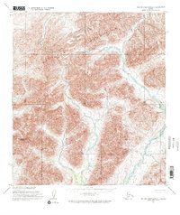
1955 Map of De Long Mountains B-1
USGS Topo · Published 1971About this map
The De Long Mountains dominate this remote northern landscape, characterized by complex topographic drainage systems and high-elevation peaks. Recorded during a mid-1950s aerial survey, the region is defined by the braided courses of the Kelly River and its various tributaries. This hydrographic network includes Wrench Creek, which carves through the western slopes near Amphitheatre Mountain. The lack of man-made structures or trails on the sheet reflects the untouched nature of this Arctic wilderness during the mid-twentieth century, highlighting a period before significant modern industrial or infrastructure development reached this part of the North Slope.
Find a feature on this map
4 named features on this map. Tap any name to fly to it.
Don’t see what you’re looking for? This feature index may not catch every label — zoom into the map to look around manually.
Map Details
Editions of this 1955 De Long Mountains B-1 Map
2 editions found
Other maps of this area

1951 · De Long Mountains
USGS Topo · 1:250,000

1951 · Misheguk Mountain
USGS Topo · 1:250,000

1955 · De Long Mountains
USGS Topo · 1:250,000

1955 · Misheguk Mountain A-5
USGS Topo · 1:63,360
1955 · De Long Mountains C-2
USGS Topo · 1:63,360

1955 · De Long Mountains A-1
USGS Topo · 1:63,360
1955 · De Long Mountains C-1
USGS Topo · 1:63,360

1955 · De Long Mountains A-2
USGS Topo · 1:63,360

1955 · De Long Mountains B-2
USGS Topo · 1:63,360
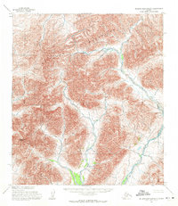
1955 · De Long Mountains B-1
USGS Topo · 1:63,360