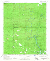
1966 Map of De Queen NW
USGS Topo · Published 1967About this map
The De Queen Reservoir dominates the lower right quadrant of this 1960s landscape, illustrating the transformative water management projects of the era along the Rolling Fork. This survey documents a critical period of change for the borderlands between Arkansas and Oklahoma, specifically where McCurtain County and Sevier County meet. The area is defined by a dense network of winding watercourses, including the serpentine Robinson Creek and Ozark Fork, which cut through the prominent elevations of Williams Mtn. Local history is preserved through the locations of rural landmarks such as Midway Ch and community burial grounds like Oak Grove Cem and Mill Creek Cem. The presence of a significant Pipeline crossing the terrain from northwest to southeast further marks the integration of industrial infrastructure into this heavily wooded, creek-fed environment.
Find a feature on this map
24 named features on this map. Tap any name to fly to it.
Don’t see what you’re looking for? This feature index may not catch every label — zoom into the map to look around manually.
Map Details
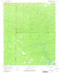
Editions of this 1966 De Queen NW Map
2 editions found
Other maps of this area

1902 · Lukfata
USGS Topo · 1:125,000

1913 · De Queen
USGS Topo · 1:125,000

1950 · Mcalester
USGS Topo · 1:250,000

1959 · Cove
USGS Topo · 1:62,500

1959 · Broken Bow
USGS Topo · 1:62,500

1960 · Smithville
USGS Topo · 1:62,500

1962 · McAlester
USGS Topo · 1:250,000

1964 · Gillham
USGS Topo · 1:24,000

1965 · McAlester
USGS Topo · 1:250,000
1965 · Chapel Hill
USGS Topo · 1:24,000