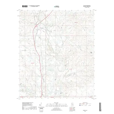
2018 Map of De Soto
USGS Topo · Published 2018About this map
The Chickasawhay River meanders through this Clarke County landscape, defining the local geography alongside the settlement of De Soto. This 2018 survey documents a region deeply connected to its rural heritage, as seen in the numerous community burial grounds scattered across the townships, including De Soto Cem, Bethel Cem, and Center Ridge Cem. The river's influence on the land is evident in features like the McCormick Cutoff and the sharp turn at Martinere Bend. To the east, the open terrain of Sels Prairie stands in contrast to the dense network of creeks and branches, such as Shubuta Creek and Coonipper Cr, that feed the primary river system. This map provides a clear view of the transportation network, from the corridor of US Route 45 to the numerous county roads that link these long-established family and community landmarks.
Find a feature on this map
67 named features on this map. Tap any name to fly to it.
Don’t see what you’re looking for? This feature index may not catch every label — zoom into the map to look around manually.
Map Details
Editions of this 2018 De Soto Map
This is the sole edition of this map. No revisions or reprints were ever made.
Other maps of this area

1953 · Hattiesburg
USGS Topo · 1:250,000

1953 · Meridian
USGS Topo · 1:250,000

1957 · Meridian
USGS Topo · 1:250,000

1957 · Quitman
USGS Topo · 1:62,500

1957 · Enterprise
USGS Topo · 1:62,500

1958 · Hattiesburg
USGS Topo · 1:250,000

1964 · Carmichael
USGS Topo · 1:24,000

1964 · Eucutta
USGS Topo · 1:24,000

1964 · Hale
USGS Topo · 1:24,000

1964 · De Soto
USGS Topo · 1:24,000