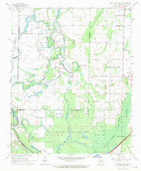
1968 Map of De Valls Bluff NE
USGS Topo · Published 1969About this map
Cotton Plant anchors the northeastern corner of this Delta landscape, where the agricultural plains of Richland meet the dense, water-heavy bottomlands of the Cache River. The terrain is defined by a complex network of wetlands and oxbow lakes, including Big Buck Lake, Heifer Lake, and Bull Lake, many of which are protected within the Dagmar State Game Area. This 1960s survey captures the region's rural social fabric through its distribution of country churches and family landmarks, such as Tricee Chapel and the Trice Cem.
Find a feature on this map
35 named features on this map. Tap any name to fly to it.
Don’t see what you’re looking for? This feature index may not catch every label — zoom into the map to look around manually.
Map Details
Editions of this 1968 De Valls Bluff NE Map
3 editions found
Other maps of this area

1935 · Gregory
USGS Topo · 1:62,500

1939 · Hunter
USGS Topo · 1:62,500

1940 · Brinkley
USGS Topo · 1:62,500

1941 · De Valls Bluff
USGS Topo · 1:62,500

1948 · Helena
USGS Topo · 1:250,000

1950 · Helena
USGS Topo · 1:250,000

1953 · Memphis
USGS Topo · 1:250,000

1955 · Helena
USGS Topo · 1:250,000

1956 · Memphis
USGS Topo · 1:250,000

1956 · Hunter
USGS Topo · 1:62,500