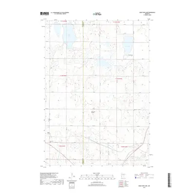
2019 Map of Dead Coon Lake
USGS Topo · Published 2019About this map
The Coteau des Prairies plateau defines this agricultural landscape where the Lincoln and Lyon County line divides a terrain of prairie potholes and glacial lakes. The city of Tyler sits in the southwestern corner, anchored by Saint Dionysius Cem and Hope Cem, marking the local history of settlement on this high ground. Water management is central to the area's development, evidenced by extensive drainage systems like Judicial Ditch Number Thirtyone and County Ditch Number Fourteen that channel water toward the Redwood River. These engineered waterways contrast with natural features like Dead Coon Lake and Wood Lake, which are accompanied by the small Mission Cem and Wood Lake Cem in the northeastern section of the map.
Find a feature on this map
39 named features on this map. Tap any name to fly to it.
Don’t see what you’re looking for? This feature index may not catch every label — zoom into the map to look around manually.
Map Details
Editions of this 2019 Dead Coon Lake Map
This is the sole edition of this map. No revisions or reprints were ever made.
Other maps of this area

1953 · Watertown
USGS Topo · 1:250,000

1953 · New Ulm
USGS Topo · 1:250,000

1957 · New Ulm
USGS Topo · 1:250,000

1958 · New Ulm
USGS Topo · 1:250,000

1958 · Watertown
USGS Topo · 1:250,000

1963 · Dead Coon Lake
USGS Topo · 1:24,000

1963 · Gislason Lake
USGS Topo · 1:24,000

1963 · Russell
USGS Topo · 1:24,000

1963 · Tyler
USGS Topo · 1:24,000

1963 · Lynd
USGS Topo · 1:24,000