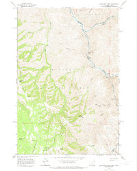
1963 Map of Deadhorse Ridge
USGS Topo · Published 1974About this map
The Snake River and Salmon River converge at the northern edge of this rugged landscape, marking the intersection of the Idaho and Oregon borders. In the early 1960s, this remote territory within the Wallowa National Forest remained largely defined by its mining history and river-based activity. Numerous prospects such as the Mountain Chief Mine, Bonnie Doone No 1 Mine, and Mabel L Mine appear near the Imnaha River, while Mine Ruins and a Footbridge are noted at the Imnaha Rapids. The terrain is punctuated by significant ridgelines including Deadhorse Ridge and Cemetery Ridge, which drop sharply toward narrow creek beds. Human presence is sparse, represented by isolated landmarks like Dobbin Cabin, Conners Cabin, and the Cherry Creek Ranch, along with several high-altitude springs and primitive jeep trails.
Find a feature on this map
57 named features on this map. Tap any name to fly to it.
Don’t see what you’re looking for? This feature index may not catch every label — zoom into the map to look around manually.
Map Details
Editions of this 1963 Deadhorse Ridge Map
3 editions found
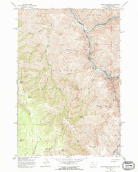
Other maps of this area

1954 · Imnaha
USGS Topo · 1:62,500

1954 · Kernan Point
USGS Topo · 1:62,500

1955 · Grangeville
USGS Topo · 1:250,000

1959 · Grangeville
USGS Topo · 1:250,000

1963 · Cactus Mtn
USGS Topo · 1:24,000

1963 · Deadhorse Ridge
USGS Topo · 1:24,000

1963 · Jim Creek Butte
USGS Topo · 1:24,000

1963 · Rattlesnake Ridge
USGS Topo · 1:24,000

1963 · Wapshilla Creek
USGS Topo · 1:24,000

1963 · Poison Point
USGS Topo · 1:24,000