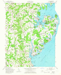
1957 Map of Deale
USGS Topo · Published 1966About this map
The western shores of the Chesapeake Bay and the Rhode River inlet define this mid-century portrait of southern Anne Arundel County. The landscape is characterized by a dense network of tidal creeks and peninsulas, where maritime activity and agricultural settlements meet. Established communities like Galesville and Shady Side serve as focal points for water-based commerce and recreation, evidenced by the Chesapeake Yacht Club and numerous wharves such as Steiners Wharf. Inland, the map documents a transition toward residential development in areas like Franklin Manor-on-the-Bay and Fairhaven-on-the-Bay, while preserving older crossroads like Owensville and Mt Zion. These rural hubs are anchored by local institutions including Chews Memorial Ch, St James Ch, and Southern High Sch. The presence of several small landings and names like Deadwood Cove and Snug Harbor reflect the region's deep-rooted connection to the estuary's inlets.
Find a feature on this map
120 named features on this map. Tap any name to fly to it.
Don’t see what you’re looking for? This feature index may not catch every label — zoom into the map to look around manually.
Map Details
Editions of this 1957 Deale Map
4 editions found
Other maps of this area

1892 · Prince Frederick
USGS Topo · 1:62,500

1892 · Owensville
USGS Topo · 1:62,500

1892 · Annapolis
USGS Topo · 1:62,500

1893 · Sharps Island
USGS Topo · 1:62,500

1895 · Prince Frederick
USGS Topo · 1:62,500

1895 · Owensville
USGS Topo · 1:62,500

1898 · Choptank
USGS Topo · 1:125,000

1899 · Patuxent
USGS Topo · 1:125,000

1901 · Prince Frederick
USGS Topo · 1:62,500

1904 · Annapolis
USGS Topo · 1:62,500