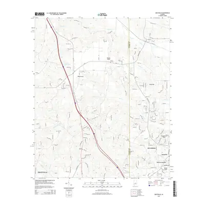
2014 Map of Deatsville
USGS Topo · Published 2014About this map
Deatsville and Pine Level anchor this detailed topography along the boundary of Autauga and Elmore counties. The landscape is defined by the headwaters of numerous waterways, including Mortar Creek and Kenner Creek, which cut through the undulating terrain near Stoney Point. The map provides a localized view of the transition between the northern outskirts of Prattville and the growing residential pockets of Millbrook, shown just before major modern expansions. Genealogists will find several small burial sites scattered throughout the rural sections, such as Pleasant Hill Cemetery, Ross Cemetery, and County Line Cemetery. Transport in the area is dominated by the corridor of Us-31, while smaller settlements like Grandview Pines and Robinson Springs illustrate the clustered community development characteristic of this part of central Alabama.
Find a feature on this map
172 named features on this map. Tap any name to fly to it.
Don’t see what you’re looking for? This feature index may not catch every label — zoom into the map to look around manually.
Map Details
Editions of this 2014 Deatsville Map
This is the sole edition of this map. No revisions or reprints were ever made.
Other maps of this area

1891 · Clanton
USGS Topo · 1:125,000

1901 · Wetumpka
USGS Topo · 1:125,000

1903 · Wetumpka
USGS Topo · 1:125,000

1927 · Montgomery
USGS Topo · 1:48,000

1930 · Montgomery
USGS Topo · 1:62,500

1953 · Montgomery
USGS Topo · 1:250,000

1956 · Montgomery
USGS Topo · 1:250,000

1957 · Montgomery
USGS Topo · 1:250,000

1957 · Autaugaville
USGS Topo · 1:62,500

1958 · Montgomery
USGS Topo · 1:62,500