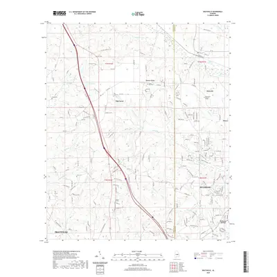
2020 Map of Deatsville
USGS Topo · Published 2020About this map
Deatsville and Pine Level anchor this landscape along the border of Autauga and Elmore counties, reflecting a suburban and rural transition north of the state capital. The map highlights the localized geography of the Pine Level Ridge and the complex drainage of the Mortar Creek and Little Bridge Run systems. Educational and community institutions are prominent, including the Ingram State Technical College and numerous family and community burial grounds such as Tatum Cem and Stoney Point Cem.
Find a feature on this map
170 named features on this map. Tap any name to fly to it.
Don’t see what you’re looking for? This feature index may not catch every label — zoom into the map to look around manually.
Map Details
Editions of this 2020 Deatsville Map
This is the sole edition of this map. No revisions or reprints were ever made.
Other maps of this area

1891 · Clanton
USGS Topo · 1:125,000

1901 · Wetumpka
USGS Topo · 1:125,000

1903 · Wetumpka
USGS Topo · 1:125,000

1927 · Montgomery
USGS Topo · 1:48,000

1930 · Montgomery
USGS Topo · 1:62,500

1953 · Montgomery
USGS Topo · 1:250,000

1956 · Montgomery
USGS Topo · 1:250,000

1957 · Montgomery
USGS Topo · 1:250,000

1957 · Autaugaville
USGS Topo · 1:62,500

1958 · Montgomery
USGS Topo · 1:62,500