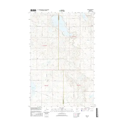
2016 Map of Debs
USGS Topo · Published 2016About this map
Clearwater Lake and the winding Clearwater River dominate this portion of the northern Minnesota landscape, where the boundary between Clearwater Co and Beltrami Co splits the terrain. The small community of Debs sits on the eastern edge of the survey, surrounded by a network of rural routes and family-named roads like Eisenmen Dr and Boorman Rd. For genealogists and local historians, the map identifies specific burial grounds including Sinclair Cem and East Zion Cem, which provide precise locations for ancestral research. The southern portion of the map is marked by the Soo Line Rd Nw, tracing the path of a significant regional transportation corridor through a wetland-rich environment that includes Tepee Lake and East Four Legged Lake.
Find a feature on this map
43 named features on this map. Tap any name to fly to it.
Don’t see what you’re looking for? This feature index may not catch every label — zoom into the map to look around manually.
Map Details
Editions of this 2016 Debs Map
This is the sole edition of this map. No revisions or reprints were ever made.
Other maps of this area

1919 · Solway
USGS Topo · 1:62,500

1919 · Churnes
USGS Topo · 1:62,500

1943 · Solway
USGS Topo · 1:62,500

1943 · Bagley
USGS Topo · 1:62,500

1954 · Bemidji
USGS Topo · 1:250,000

1957 · Bemidji
USGS Topo · 1:250,000

1958 · Bemidji
USGS Topo · 1:250,000

1969 · Leonard
USGS Topo · 1:24,000

1969 · Shevlin
USGS Topo · 1:24,000

1972 · Bagley Lake
USGS Topo · 1:24,000