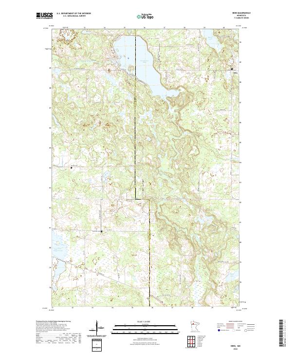
2022 Map of Debs
USGS Topo · Published 2022About this map
The Clearwater River winds through the borderlands of Clearwater and Beltrami counties, feeding into the prominent Clearwater Lake near the small settlement of Debs. This 2022 survey captures a landscape defined by its glacial lakes and a network of rural county roads that connect remote homesteads and local landmarks. Genealogists and local historians can locate several burial grounds preserved in this area, including Roosevely Cem near the lake’s eastern shore, Sinclair Cem to the south, and East Zion Cem along Co Rd 80. The map documents the persistent rural character of Northern Minnesota, where water bodies like Myrtle Lake, Tepee Lake, and the uniquely named East Four Legged Lake punctuate the wooded terrain. The road network, including Balsam Bay Rd and Roosevelt Ridge Rd, suggests a community oriented toward the water.
Find a feature on this map
48 named features on this map. Tap any name to fly to it.
Don’t see what you’re looking for? This feature index may not catch every label — zoom into the map to look around manually.
Map Details
Editions of this 2022 Debs Map
This is the sole edition of this map. No revisions or reprints were ever made.
Other maps of this area

1919 · Solway
USGS Topo · 1:62,500

1919 · Churnes
USGS Topo · 1:62,500

1943 · Solway
USGS Topo · 1:62,500

1943 · Bagley
USGS Topo · 1:62,500

1954 · Bemidji
USGS Topo · 1:250,000

1957 · Bemidji
USGS Topo · 1:250,000

1958 · Bemidji
USGS Topo · 1:250,000

1969 · Leonard
USGS Topo · 1:24,000

1969 · Shevlin
USGS Topo · 1:24,000

1972 · Bagley Lake
USGS Topo · 1:24,000