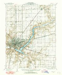
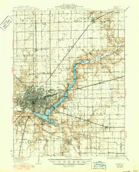
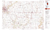
1958 Map of Decatur
USGS Topo · Published 1971This historical map portrays the area of Decatur in 1958, primarily covering Macon County as well as portions of Coles County, Clark County, Macoupin County, Moultrie County, Cass County, Menard County, Effingham, Christian County, Champaign County, Morgan County, Sangamon County, Cumberland County, Montgomery County, Jasper County, Logan County, Fayette County, Shelby County, Douglas County, Bond County, and Piatt County. Featuring a scale of 1:250000, this map provides a highly detailed snapshot of the terrain, roads, buildings, counties, and historical landmarks in the Decatur region at the time. Published in 1971, it is one of 3 known editions of this map due to revisions or reprints.
Find a feature on this map
116 named features on this map. Tap any name to fly to it.
Don’t see what you’re looking for? This feature index may not catch every label — zoom into the map to look around manually.
Map Details
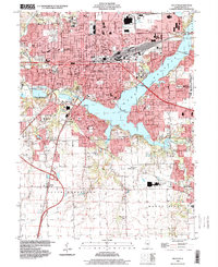
Editions of this 1958 Decatur Map
3 editions found
Historical Maps of Chapin Through Time
7 maps found