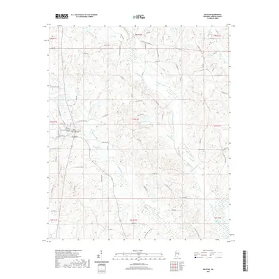
2020 Map of Decatur
USGS Topo · Published 2020About this map
Decatur serves as the focal point of this Newton County survey, centered around the Newton County Courthouse and the expansive campus of East Central Community College. The landscape is defined by a dense network of waterways, including the winding Okahatta Creek and the modified path of the Chunky Canal. These streams and their many tributaries, such as McMullan Br and Carlton Br, dictate the undulating terrain and the placement of the rural road network. Outside the town center, the map reveals a pattern of dispersed homesteads and family-associated landmarks. Genealogists will find several burial sites noted, including Decatur Cem, Johnson Cem, and Brand Cem. The area maintains its character through numerous local routes like Little Rock Decatur Rd and Sand Springs Church Rd, which connect the small-scale agricultural and wooded parcels typical of this part of Mississippi.
Find a feature on this map
91 named features on this map. Tap any name to fly to it.
Don’t see what you’re looking for? This feature index may not catch every label — zoom into the map to look around manually.
Map Details
Editions of this 2020 Decatur Map
This is the sole edition of this map. No revisions or reprints were ever made.
Other maps of this area

1953 · Meridian
USGS Topo · 1:250,000

1957 · Meridian
USGS Topo · 1:250,000

1957 · Chunky
USGS Topo · 1:62,500

1962 · Post
USGS Topo · 1:24,000

1965 · Meridian
USGS Topo · 1:250,000

1966 · Hickory
USGS Topo · 1:24,000

1966 · Newton
USGS Topo · 1:24,000

1966 · Decatur NW
USGS Topo · 1:24,000

1966 · Decatur
USGS Topo · 1:24,000

1972 · Union East
USGS Topo · 1:24,000