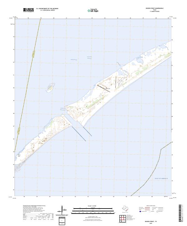
2025 Map of Decros Point
USGS Topo · Published 2025About this map
Decros Point anchors this coastal survey, marking the southwestern tip of the peninsula where the Matagorda Ship Channel cuts through the barrier island. This maritime landscape is defined by the critical transit route of the Intracoastal Waterway, which facilitates sheltered navigation along the Texas coast behind the protective dunes. The map highlights a environment shaped by coastal engineering and military presence, notably at Pierce Field, situated on the thin strip of land between the open Gulf of America and the expansive Matagorda Bay. The boundary between Calhoun and Matagorda counties bisects the bay, illustrating the administrative divisions of these vital salt-water estuaries. Researchers can trace the modern contours of the barrier shoreline and the deep-water access points that serve the region's shipping and defense infrastructure.
Find a feature on this map
7 named features on this map. Tap any name to fly to it.
Don’t see what you’re looking for? This feature index may not catch every label — zoom into the map to look around manually.
Map Details
Editions of this 2025 Decros Point Map
This is the sole edition of this map. No revisions or reprints were ever made.
Other maps of this area

1951 · Keller Bay
USGS Topo · 1:24,000

1952 · Palacios Point
USGS Topo · 1:24,000

1952 · Pass Cavallo SW
USGS Topo · 1:24,000

1952 · South of Palacios Point
USGS Topo · 1:24,000

1952 · Decros Point
USGS Topo · 1:24,000

1952 · Port O'Connor
USGS Topo · 1:24,000

1953 · Beeville
USGS Topo · 1:250,000

1956 · Beeville
USGS Topo · 1:250,000

1960 · Beeville
USGS Topo · 1:250,000
1980 · Carancahua Pass
USGS Topo · 1:24,000