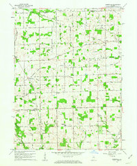
1960 Map of Deedsville
USGS Topo · Published 1963About this map
The Chicago and St Louis RR anchors the small settlement of Deedsville in this 1960 topographic study of northern Miami County. This agricultural landscape is deeply etched by a complex drainage system, featuring an extensive network of ditches such as Robbins Ditch and Runkle Ditch that feed into Weesau Creek. The map documents a significant cultural transition, clearly marking the Old Indian Treaty Boundary as it cuts across the townships of Allen, Union, and Richland. Genealogy and local history are well-preserved through the mapping of rural institutions, including the North Miami High Sch, Ebenezer Ch, and numerous small family or community burial grounds like Musselman Cem and Tilden Cem. The small centers of Macy, Gilead, and Birmingham serve as the primary hubs for this rural Indiana community, connected by a network of established roads like the Macy Gilead Road.
Find a feature on this map
42 named features on this map. Tap any name to fly to it.
Don’t see what you’re looking for? This feature index may not catch every label — zoom into the map to look around manually.
Map Details
Editions of this 1960 Deedsville Map
2 editions found
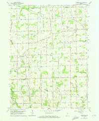
Other maps of this area

1951 · Peru
USGS Topo · 1:24,000

1951 · Twelve Mile
USGS Topo · 1:24,000

1951 · Richvalley
USGS Topo · 1:24,000

1953 · Fort Wayne
USGS Topo · 1:250,000

1953 · Chicago
USGS Topo · 1:250,000

1953 · Danville
USGS Topo · 1:250,000

1953 · Muncie
USGS Topo · 1:250,000

1955 · Danville
USGS Topo · 1:250,000

1956 · Muncie
USGS Topo · 1:250,000

1956 · Danville
USGS Topo · 1:250,000