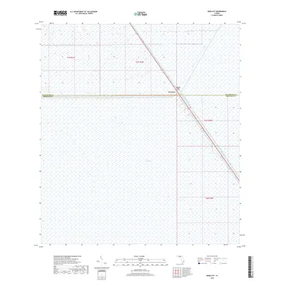
2018 Map of Deem City
USGS Topo · Published 2018About this map
The Everglades dominates the landscape of this 2018 survey, reflecting the persistent hydrology of southern Florida's interior. Human presence is concentrated along the industrial corridor of the North New River Canal, which serves as a major hydraulic artery and a path for transportation through the wetlands. The small settlements of Deem City and Terrytown are positioned directly on this canal, marking a point of transition at the border of Palm Beach and Broward Counties. The map illustrates a highly managed environment where precise township and range lines overlay the vast, water-rich terrain, highlighting the intersection of civil engineering and the natural ecosystem of the river of grass in the modern era.
Find a feature on this map
5 named features on this map. Tap any name to fly to it.
Don’t see what you’re looking for? This feature index may not catch every label — zoom into the map to look around manually.
Map Details
Editions of this 2018 Deem City Map
This is the sole edition of this map. No revisions or reprints were ever made.
Other maps of this area

1956 · West Palm Beach
USGS Topo · 1:250,000

1957 · West Palm Beach
USGS Topo · 1:250,000

1958 · West Palm Beach
USGS Topo · 1:250,000

1963 · Andytown
USGS Topo · 1:24,000

1973 · Everglades 4 NW
USGS Topo · 1:24,000

1973 · Everglades 4 NE
USGS Topo · 1:24,000

1973 · Fort Lauderdale 2 SW
USGS Topo · 1:24,000

1974 · Everglades 1 SW
USGS Topo · 1:24,000

1974 · Everglades 1 NW
USGS Topo · 1:24,000

1974 · Everglades 1 SE
USGS Topo · 1:24,000