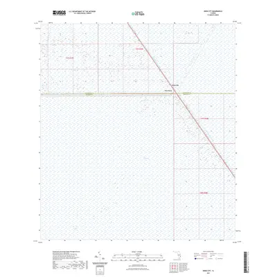
2021 Map of Deem City
USGS Topo · Published 2021About this map
The Everglades dominate this landscape, illustrating the vast, water-saturated terrain characteristic of this portion of Florida. The map highlights the sparse human footprint in this region, primarily concentrated at the intersection of local routes and the North New River Canal. Small settlements like Deem City and Terrytown sit near the border between Palm Beach and Broward counties, serving as isolated outposts amidst the surrounding wetlands. This 2021 survey emphasizes the critical role of engineered waterways in managing the environment and providing transit corridors through the marshland. Researchers will find interest in the precise placement of these modern settlements in relation to the longstanding drainage systems that have shaped the development of southern Florida's interior.
Find a feature on this map
8 named features on this map. Tap any name to fly to it.
Don’t see what you’re looking for? This feature index may not catch every label — zoom into the map to look around manually.
Map Details
Editions of this 2021 Deem City Map
This is the sole edition of this map. No revisions or reprints were ever made.
Other maps of this area

1956 · West Palm Beach
USGS Topo · 1:250,000

1957 · West Palm Beach
USGS Topo · 1:250,000

1958 · West Palm Beach
USGS Topo · 1:250,000

1963 · Andytown
USGS Topo · 1:24,000

1973 · Everglades 4 NW
USGS Topo · 1:24,000

1973 · Everglades 4 NE
USGS Topo · 1:24,000

1973 · Fort Lauderdale 2 SW
USGS Topo · 1:24,000

1974 · Everglades 1 SW
USGS Topo · 1:24,000

1974 · Everglades 1 NW
USGS Topo · 1:24,000

1974 · Everglades 1 SE
USGS Topo · 1:24,000